Total GIS Converter Utility
4.87/5 (122 Reviews)
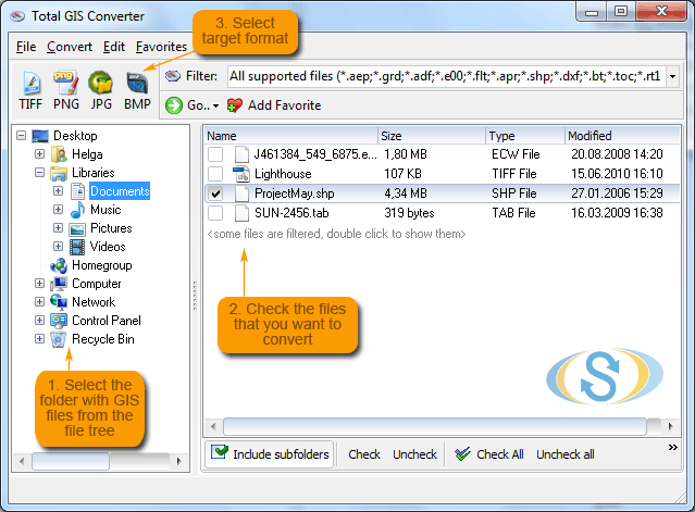
Total GIS Converter is a powerful converter of GIS files.
Multimedia And Design
Image And Graphic Design
Shareware
FREE DOWNLOAD (v1.5)
File Size: 7772KB | Official Download
Key Features of Total GIS Converter
- Total GIS Converter is an affordable converter of GIS files.
- It converts AEP, GRD, ADF, E00, FLT, APR, SHP, DXF, BT, TOC, RT1, DEM, DLG, ECW, IMG, DGF, GML, SID, MIF, TAB, WOR, TTKPS, TTKGP, TTKLS, LFT, PFT, and TFT files.
- The target formats are TIFF, PNG, JPEG, BMP.
- It can also scale the output files to optimize their size.Total GIS Converter processes GIS files in batches and keep folders` structure.
Technical Specifications
- Publisher: Coolutils.com
- License: Shareware
- Operating System: Windows 7, Windows 8, Windows 10, Windows 11
- Category: Multimedia And Design / Image And Graphic Design
Total GIS Converter Screenshot